

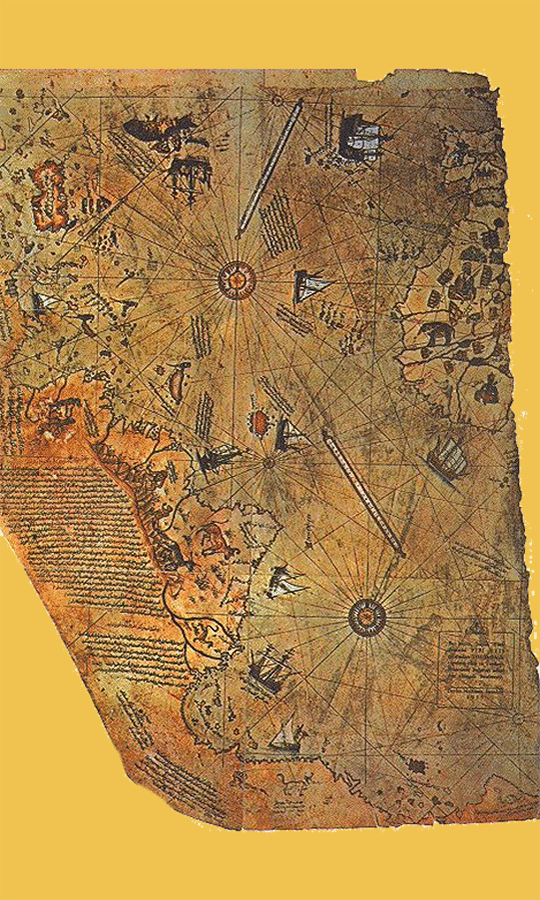
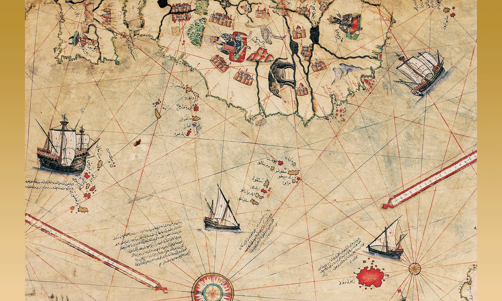
The map of Piri Reis is an ancient map of Portulan-style. It was discovered in 1929 during the restoration of the Topkapı palace in Istanbul. This map is attributed to the Ottoman admiral and cartographer Piri Reis who would have drawn it in 1513. Drawn on a gazelle skin, it details the western coasts of Africa and the eastern coasts of South America.
First question: why was this famous map, discovered in 1929, only known to researchers and the general public around the change of millennium? Seventy years lost for nothing… On the other hand, this map is said to have been found with a dozen ancient maps, including Greek and Roman ones. Why haven’t we seen them yet?
We will thus discover a multitude of irregularities, bizarre arrangements with a doubtful truth, the most visible being, as often, the work of scientists.
 The Passion of Piri Reis
What we call a maritime chart was once called a portolan. In 1480, when Piri Reis came into the world, the portulans had existed for nearly two centuries. But Piri Reis was going to give them a quality and a usefulness never before equaled.
Admiral Piri was an enthusiast, capable of sacrificing almost everything to that love that held him screwed onto his drawing table, correcting, tracing, erasing, drawing more finely, inking with a brush, endlessly on the loom putting back his work.
“Hurry slowly; and, without losing heart,
Twenty times on the job hand in your work:
Polish it constantly and repolish it;
Add sometimes, and often delete.”
Nicolas Boileau(and not Jacques Prévert who is often quoted by mistake)
Piri Reis made many maps of the Mediterranean, mainly for his landmark work, the Kitâb-ı Bahrriyye or Book of Navigation. We will see some of them later.
But nowadays it is best known for a certain map of the Atlantic Ocean, with its shores and islands, a map that has come down to us in fragments, and which has raised many questions, stings and diatribes.
It is unfairly called the map of Piri Reis, while he traced so many others, Mediterranean Sea mainly.
The Map of Piri Reis
This map of Piri Reis is only the fragment of a map three times larger representing the known world at the time when it was made, the rest of which is now lost; thus only the part concerning the Atlantic Ocean remains. see the image to the right According to its colophon, this map was made in 1513. Piri Reis indicates in his works having offered it to Selim I during his stay in Cairo, that is to say in 1517.
Colophon? Final note of a written work, providing the references and indications about said work.
The Turkish admiral says he was inspired by about twenty maps, ranging from ancient Greek maps to a map established by Christopher Columbus, or even those established by other Portuguese navigators. This is a very complete map for the time.
One of the characteristics of this map is the detailed representation of a coast connected to the southern zone of South America, which some say resembles the coast of Antarctica, a continent that was only officially discovered in 1818. This interpretation is supported notably by Charles Hapgood, American professor of the history of sciences, in his book Maps of the Ancient Kings of the Seas.
His Origin
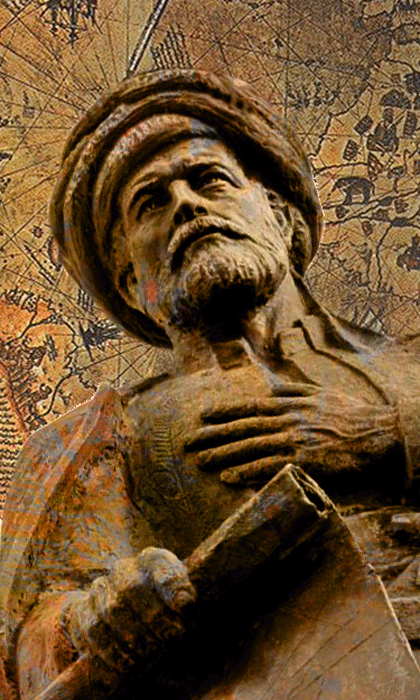
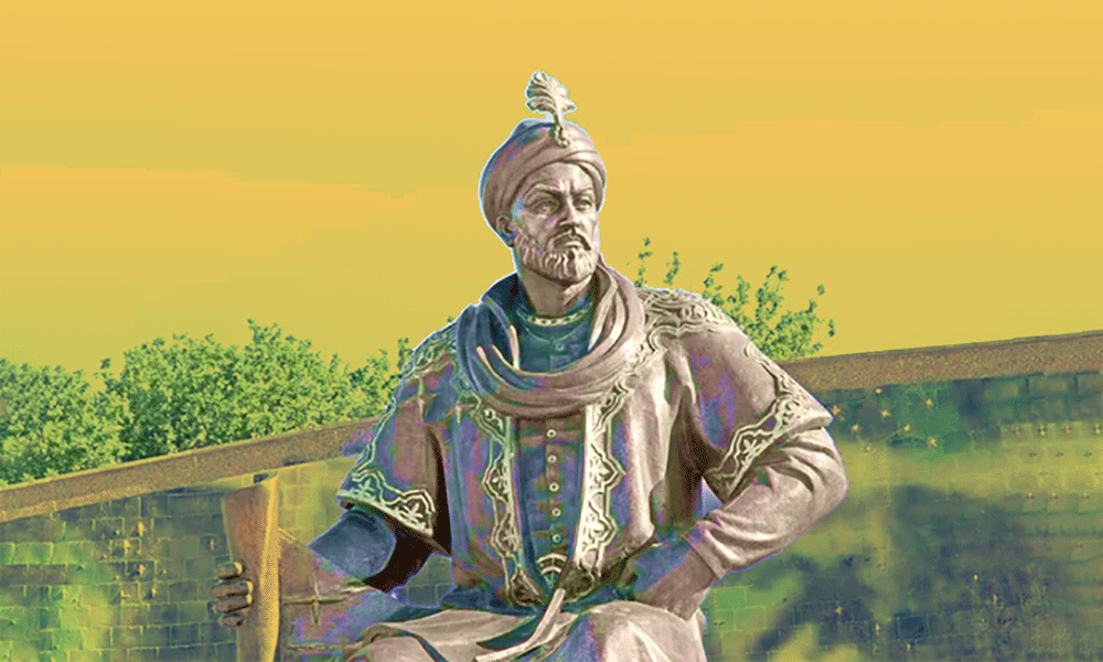
From his real name Ahmed Muhiddîne Piri ibn Hajji Mehmed, he was better known as Piri Reis, from his Arabic nickname Ra’is-al-Bahr, Chief of the Seas, called so for his excellence in the naval field. He was born between 1465 and 1470 in the city of KaramanOr in that of Gelibolu (Turkey).
Statue of Piri Reis (~~1480 – 1554) erected in Alishahane, Turkey.
He was the nephew of Kamal Reis, a great man forgotten in our community, with whom he participated in many naval battles against the Spanish, Genoese and Portuguese navies, who relentlessly attacked the Muslims living on the Mediterranean coasts. Later, he will also fight with the illustrious Khayreddine, better known by the nickname of Barbarossa. (source)
His Youth
At that time, the Ottoman state hardly maintained permanent naval forces, but compelled its corsairs to serve in a regular framework in times of war. Such was the case during the conflict between the Porte and Venice from 1499 to 1502, in which Kemal Re’îs and his nephew took part. It is presumed that the latter came to settle at the naval base of Gallipolí, on the Dardanelles, after 1511 where his uncle perished at sea.
Two years later, he completed his famous map of the world of which only one fragment has survived: the one featuring the Atlantic coasts of America, West Africa, Morocco, Spain and France. Between 1513 and 1529, he drew two maps of the world, including maps and data from his collection, some of which date back to antiquity.
The most famous is that of 1513, nicknamed the Map of Piri Reis; it was discovered in 1929 at the Topkapı Palace in Istanbul. The second remained unfinished. He also wrote a book, Kitab-ı Bahriye or Navigation Book, in which there are more than 200 maps mainly representing the Mediterranean Sea. (Le monde des cartes, de Jean-Louis Bacqué-Grammont, Directeur de recherches au CNRS)
At that time, we did not have aerial views or satellite photos and yet this famous map has a degree of accuracy that intrigues more than one researcher. Some consider the card as an oopart.
Oopart? Contraction of out of place artifact, incongruous manufactured object, which should not be there.
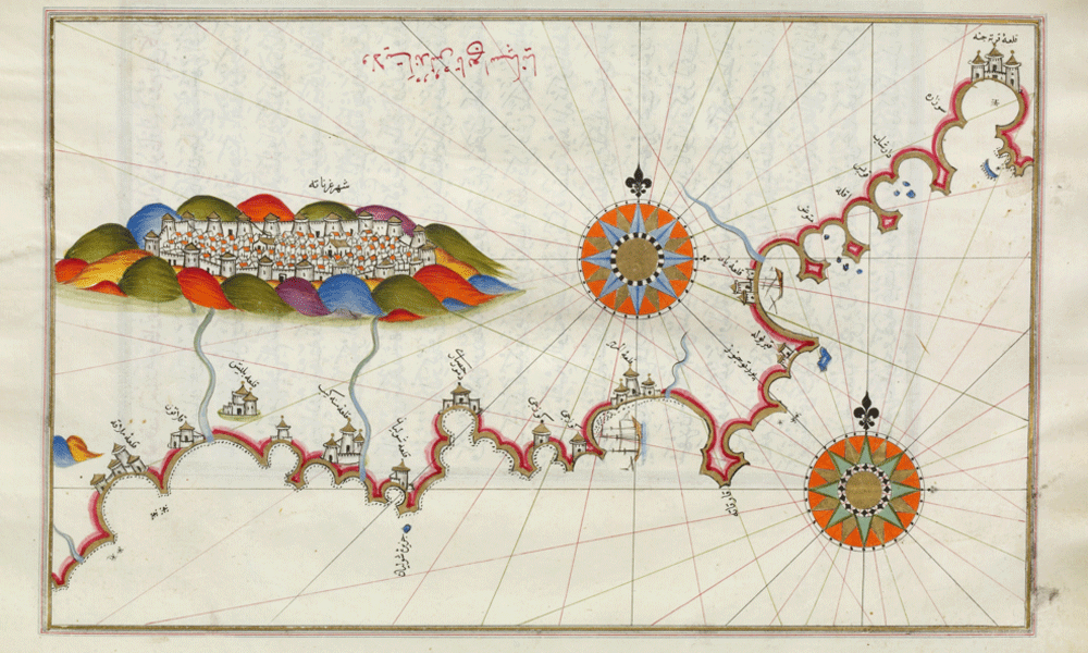
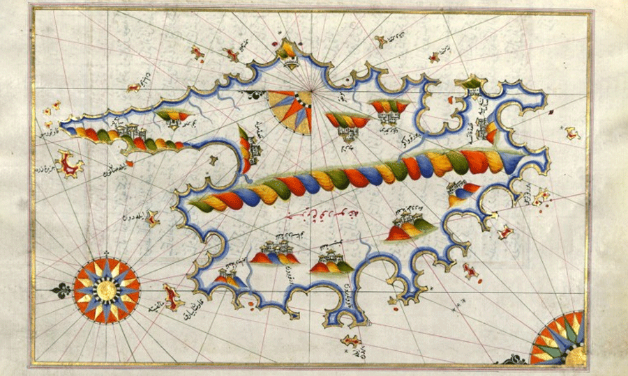 Map of Corsica, by Piri Reis
Incongruous? Did you say incongruous?
His map of the Atlantic is indeed very incongruous. And very controversial! Carried out 300 years before the discovery of Antarctica, it shows the invisible coast under the ice — which would bring the information back to 10,000 years. Scientific studies question this interpretation. (wikipedia)
The “science” refuses any evidence on this burning subject. Doctrinaire and limited, this pseudo-science does not support the suggestion that distant eras have been as much or even more developed than us.
Hence the notion of oopart. The map is incongruous, that is to say not in accordance with generally accepted scientific beliefs. Yesterday, we admitted others that we are mocking today. Tomorrow we will burn the current beliefs to worship those we hold as incongruous.
 Why should we be surprised that such useful information as a nautical chart has been accurately transmitted over long periods of time? We have testimonies, certainly less faithful, of events and beings that have disappeared for millennia. This entire site is based on the study of such facts, so ancient that most researchers consider them mythical. Which, for them, mean whimsical. Works of imagination, totally disconnected from any reality…
If that were the case, how to explain that we find the same fantasies all around the world? If it were pure inventions, delusions, all myths would be different. Which is not the case, on the contrary. All mythologies contain the same story… which we will have to take seriously.
Ancient Sources
From the Greco-Latin heritage, the geography of the Western Middle Ages had retained a bookish teaching, transmitted by the compilers of late Antiquity, such as Strabo, Pomponius Mela, Solin, Macrobe, Orose. On medieval maps, the sphericity of the earth seemed forgotten, whereas it was known by Anaximander, six centuries before the common era (AEC).
If the identification of the coasts of Antarctica proves to be accurate, it would prove that Piri Reis had access to documents transmitted through ten millennia before reaching his hands. When Anaximander claims that the earth is spherical, hasn’t he also inherited a teaching of vertiginous antiquity from the former gods, terraformers, cyclops and dragons?
Portulans’ Age
The appearance, in the 14th century, of the portulan card marks a right-angled turning point in the use and design of cards. The ports are primarily intended for navigation. To this end, they must provide information as accurate as possible. To be reliable, they must be faithful to the terrain. The coastline, in particular, requires the best precision.
On this plan, the portlans of Admiral Piri Reis are quite estimable. They date from the 16th century and thanks to the Turkish admiral, they benefited from specific knowledge acquired or found by the Arab world.
The eastern Mediterranean, in particular, is particularly described.
Aeroplanes?
An exaggeration of the time makes the Mediterranean not only the center of the world, but also a sea larger than the oceans. Piri Reis created two portulans of the Atlantic Ocean, showing portions of the European coast and also the American coast.
A legend claims that the grand admiral of the Ottoman fleet traced them from the original map used by Christopher Columbus himself. One thing is certain: these portlans remain wonderfully documented for 1513.
It is obvious that Piri Reis, like the other authors of portulans, drew inspiration from older research and maps. Who had drawn them? That is the question we are entitled to ask. It is not only the coasts of Antarctica, covered with ice for ages, that pose problems. There is the precision of American or Asian coasts that suggests the use of aerial views.
Which is not impossible: King Solomon had the use of a flying machine, and so did the Argonauts. The former gods descended from the sky on their enormous mothership, fully equipped for accurate surveys of all coasts, including those hidden under the ice. They possessed technology that we are still very far from…
All the gods came from Hyperborea.
 Kitâb-i Bahriye — Republic of Granada
Kitâb-i Bahrriyye
The work entitled Kitab-I Bahriyye, due to the talent of the geographer Piri Reis, remains the most striking example of Ottoman geography and cartographic history. It contains more than 200 original maps with bright colors. Using a surprisingly modern technology for the sixteenth century, the Kitab-I Bahriye is full of good information about ports, coasts and islands. It is a complete atlas of Aegean and Mediterranean ports. Its many maps have long been kept secret, both for maritime use and for the development of new maps.
The first completion date of the work is 927’ (1521). Piri Reis writes that his father Kemal Reis and his friends, during their trips at sea, evaluated the materials he collected and warmly thanked him for this magnificent gift. “An irreplaceable tool,” said Kemal Reis.
In its two versions, the Kitâb-i Bahriyye holds a special place in the history of nautical literature. When it was written, the West had known for several centuries the portolan in the strict sense: a text indicating the characteristics of ports and anchorages, the distance separating them, the reefs, the shoals, etc. On the other hand, there were the portlane maps, generally on a large scale, which constituted a completely different type of document.
Piri Re’îs does pioneering work by bringing together one and the other: each chapter of the portulan ends with a map on a scale much lower than those generally practiced in Europe at that time. In its 1521 version, the work is clearly a manual for navigators where the quantity and quality of the information are the first concern, well before that of the beauty of the manuscript. (source)Le monde des cartes, Jean-Louis Bacqué-Grammont, Directeur de recherches au CNRS
America Is Back
- America Was Often Discovered
- The Portulans
- The Map of Piri Reis
- Conquistadores
- The Murderers Of The Atlantic
- The Black Slavery
- The Black Code
The Third Testament
- Under The Sign Of Tetramorph
- Inside The Tetramorph
- A Solomon Love
- The Seven Deadly Sins
- The Pharaoh of Exodus
- Moses At Sinai
- Decalogue Lessons
- Moses and the Lost Ark
- General Yahweh’s Ark
- The Seal Of Solomon
- The Glory of Shekinah
- Abram Son Of Ram
- Deadly Ark
- The Giants Of Palestine
- The Star of David
- David and Yahweh
- The Yahweh Method
- Yahweh Zeus
- Solomon The Just
- The Temple of Jerusalem
- The Thrones Of Solomon
- Queen Of Sheba
- King Menelik Of Ethiopia
- Abraham Denies Ram
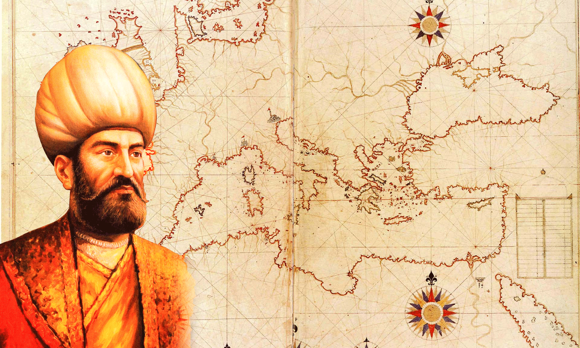
 Ottoman admiral Piri Reis, cartographer, scientist